Planning Cities with People
Many people ask me, why didn’t you continue your father’s profession as a painter? My answer is, I did. My father’s painting was a few centimeters in size. My painting is thousands of square kilometers in size.
— Liu Thai Ker, designer of Singapore city
Liu Thai Ker, the designer of Singapore city, explains that he did continue his father’s profession as a painter, but in a different way. While his father’s painting was small, Liu’s paintings are thousands of square kilometers in size. This quote is an analogy for his work as a city designer.
When Singapore became independent in 1965, it was marred by poverty and squatters. The government decided to build good quality affordable housing for everyone, and within thirty years, all the squatters were gone, and Singapore had enough housing for everyone.
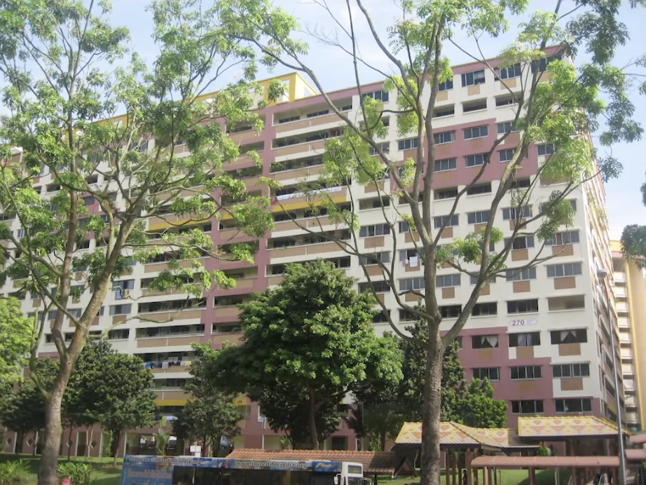
Liu looked for “design genes” in creating a new city, such as customs, culture, and environment. For example, in many Asian countries, including Singapore, strong colors are not common, as even strong colors become pastel colors under the strong sun.

Pastel colour buildings in Singapore. Bright colours turn to pastel colours due to the amount of sunshine.
Sunlight is an important factor for healthy living. Heights of the building is crucial for allowing the appropriate amount sunlight to reach all homes. Liu considered the height of buildings when designing cities. The height of a building depends on the position of the city itself and its surroundings. Liu used a chess-like design when planning the location of apartment complexes, where every black block is a building, and every white area is a garden or low-rise convenience market.
Even the height of building can be determined by the geographical location of the city. Samuel Hughes did a wonderful exposition on how tall can the buildings be depend on the city itself. Most of Bay Area has a ceiling of two storeys. Growing up in London, Samuel believed it had to be at least four or five, since that is the norm for Gregorian terraces.

Gregorian structures with three floors.
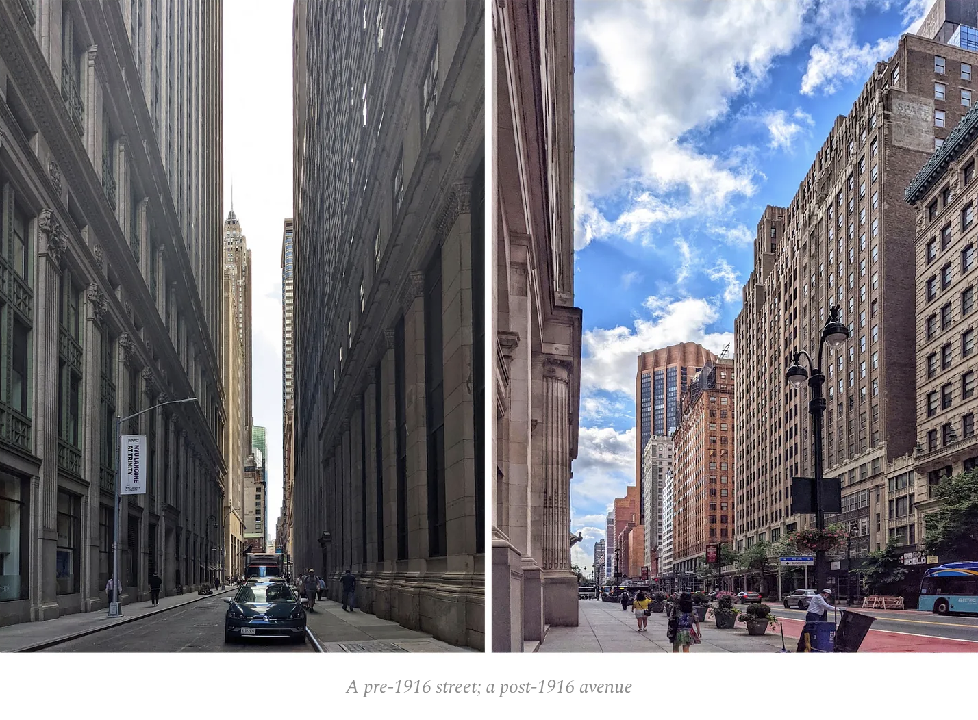
Visiting Manhattan made him realise it might be way more. The height of the building cannot be absolutely determined without considering the building’s surroundings. For example, the width of the street plays a role.
Take a look at this side-by-side comparison between a pre-1916 street in New York and post-1916 avenue. The biggest difference is the streets are allowed to be wide.

In many American cities, grocery stores are far from residential areas. As a result, families have to buy enough groceries for two to three weeks, including items that should be bought fresh, such as bread, vegetables, and fruits. This situation has led to an increase in processed food consumption. Companies have been incentivized to add more preservatives to their items so that they do not spoil so quickly.
Johnny Harris did an interesting comparison of bread from the US and France. France has 30,000 independent bakeries, while the US has only 3,000 independent bakeries. Watch it on YouTube.
In the US, zoning has created sprawling suburbs with neighborhoods of single-family homes, leading to longer commutes and increased traffic. This wasteful and costly land use pattern is a result of separating land uses into distinct zones.
European countries, where zoning actually originated, took a different approach. They emphasized mixed-use development and limited the number of zones. Germany, for example, has only four basic zone types: residential, mixed, commercial, and special, each with its own subclasses. This leads to more walkable, charming cities where people can access essential services without relying on cars and reduces the carbon footprint of cities.
Transportation safety matters too. This could be the subject of another blog but you should check out City Beautiful channel on YouTube. I will just give you one case in point: arterial road design. They are among the deadliest roads for pedestrians and cyclists. They account for 12% of all roads and 57% of all traffic fatalities.
The arterial road design is a type of road network design that involves the construction of high-speed, multi-lane roads with limited access points. These roads are designed to handle large volumes of traffic and to provide fast and efficient travel between destinations. However, studies have shown that arterial roads are also associated with a higher risk of accidents and fatalities.
In conclusion, urban planning is a crucial aspect of any city’s development. The design of cities can have a significant impact on the health, safety, and well-being of its residents. While some urban planning decisions may seem harmless, such as the atrial road design, their impact on public safety cannot be ignored.
As we continue to shape and reshape our cities, it is important to consider the long-term effects of our choices. Only by prioritizing the needs of the people and the environment can we create truly sustainable and livable cities for generations to come. Remember, the cities we build today are the legacy we leave for tomorrow.